
Trace a Kissimmee Street Address
A sound Kissimmee street directory search moves from the exact address to the parcel, then to the owner and recorded deed. It does not jump from a name on one screen to a claim about who lives there. The Osceola County Property Appraiser supplies the current parcel anchor. Official Records supplies the recorded chain. Voter and historical records can add evidence of residence, but each has gaps and access limits.
Use this order for a street-by-street search:
- Standardize the address with USPS, then confirm city limits. A Kissimmee postal label may point to an unincorporated Osceola County parcel.
- Open the exact parcel in the Osceola Property Search. Save its account number, situs address, owner mailing address, legal description, and deed reference.
- Use the Property Appraiser map to inspect parcel lines and nearby lots. Open each parcel card rather than treating a map label as proof.
- Search the owner as grantee in Osceola Official Records. Match the legal description and instrument number before following the seller backward.
- Add permit, lawful voter-record, directory, census, or newspaper evidence as the question requires. Keep every source and search date in the notes.
The chain is address → parcel → owner → deed → supporting resident evidence. That order helps prevent a same-name mistake and preserves the difference between ownership and occupancy.
Save the source record before moving on. Street numbers may be typed in more than one form, names can be abbreviated, and a portal can update after the search. A screen capture or citation should include the parcel identifier and search date. When two possible parcels appear, compare the legal description, municipality, and mapped position before accepting either one. This small check matters in fast-growing parts of Osceola County, where the postal name alone may not narrow the place enough.
Kissimmee Street Directory Parcel Search
The Property Appraiser is the best current starting point by address. Its street matches can surface likely parcels even when only part of a street name is entered. A parcel card can show the account identifier, owner, owner mailing address, situs address, legal description, land use, values, exemptions, sales references, and building facts. Homestead may support owner-occupancy, but it never lists every person in a home.
| Search control | Input | Best street use | Limit |
|---|---|---|---|
| Owner Name | Text or autocomplete | Find parcels tied to a known owner | Ownership is not occupancy |
| Property Address | Text or autocomplete | Match a situs address or street fragment | Confirm the exact parcel |
| Parcel ID / Account | Identifier | Return to one verified parcel | Requires a known key |
| Subdivision | List or text | Group platted lots | Not the same as a ZIP or city limit |
| Search / Clear | Buttons | Run or reset criteria | Fields may vary by mode |
The live property-search screen shows the address and owner entry points used in this workflow.
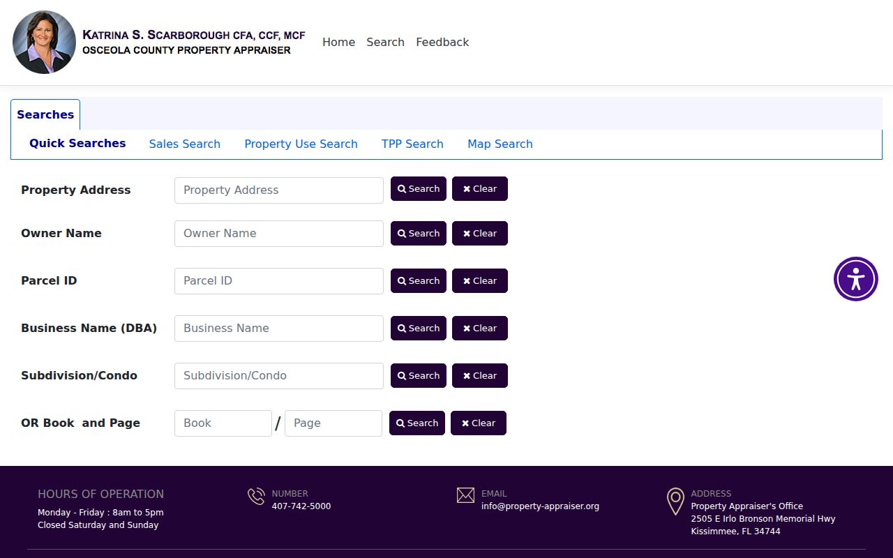
The screen is a starting index. The parcel card and its legal description provide the stronger link to later deed research.
Insider tip. Search the owner mailing address separately from the situs. The first receives tax mail; the second identifies the land being researched.
Address Records Across Kissimmee Streets
No single roll is a complete Kissimmee street directory. The record sets below answer different questions and have distinct access channels. Online portals handle many current searches. Missing images or old books route to the courthouse, Records Center, a written request, the library, or an archive.
| Address source | Keeper | Street evidence | How to reach it |
|---|---|---|---|
| Parcel and tax roll | Osceola Property Appraiser | Owner, situs, mailing, legal description, sales | Free search, map, annual roll downloads, custom request |
| GIS layers | Property Appraiser and city | Parcel shapes, aerials, zoning, flood, city limits | Interactive viewer and GIS data page |
| Deeds and liens | Osceola Clerk | Parties, dates, instrument, book/page | SearchNG, counter, mail, JustFOIA, Records Center |
| Permits and code files | City or county by jurisdiction | Project address, applicant, contractor, dates | EnerGov or a focused public-record request |
| Voter records | Supervisor of Elections | Lawful residence evidence with protected gaps | Individual status lookup or controlled file request |
| Historical sources | Libraries and archives | Named people, firms, structures, old street labels | Digital scan, reference desk, appointment, staff request |
The Property Appraiser data page links certified tax rolls, subdivision lists, absentee-owner sets, and GIS resources.
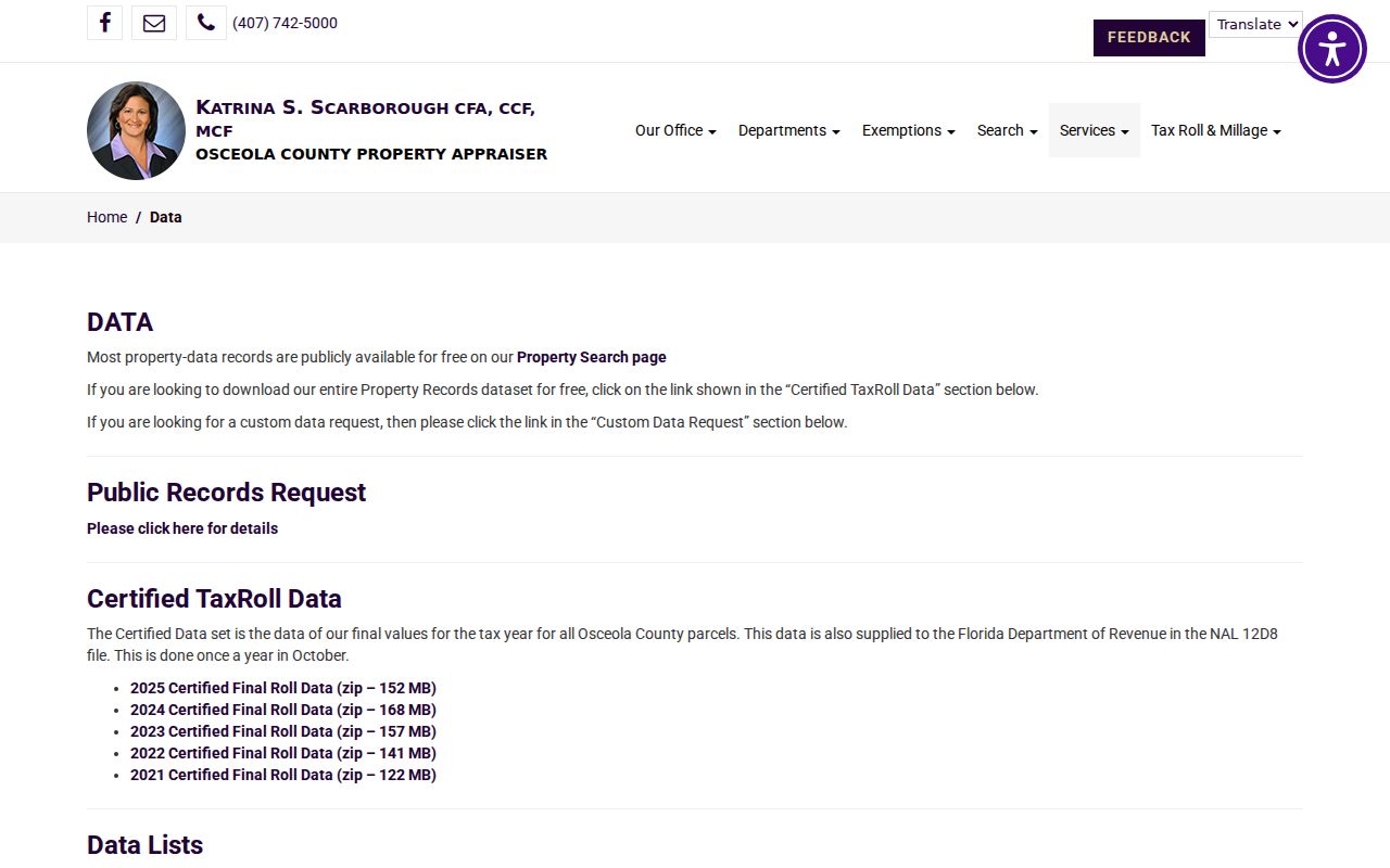
Those downloads can support a broader street segment, while the live parcel card remains the best way to verify one address.
Kissimmee Address Terms That Matter
Three address forms may appear for one parcel. Mixing them can break a search or send a request to the wrong custodian. The legal description remains the durable land key when a street label changes.
- Parcel
- A mapped piece of land with a county account or parcel identifier.
- Situs address
- The physical location assigned to the parcel, not the address where its owner receives tax mail.
- Plat
- A recorded map that divides a subdivision into lots and blocks.
- Legal description
- The lot, block, subdivision, or survey wording that identifies land in recorded instruments.
- Criss-cross directory
- A later directory arranged by street or address instead of only by surname.
No verified continuous Kissimmee criss-cross run was found. Ask the State Library, Osceola Library reference staff, or Spence Research Center to confirm a specific year before relying on one.
Follow Kissimmee Deeds by Street
A deed chain extends the street directory beyond the current tax roll. Start with the acquisition deed cited on the parcel card. Record the grantee, grantor, recording date, instrument number, and legal description. Next, search the seller as an earlier grantee. Repeat while the land description still matches. Party names in a filing show recorded roles; the Clerk does not perform a title search or guarantee that a signer owned the land.
The Official Records SearchNG interface offers party, date, document type, instrument, book/page, and legal-description routes.
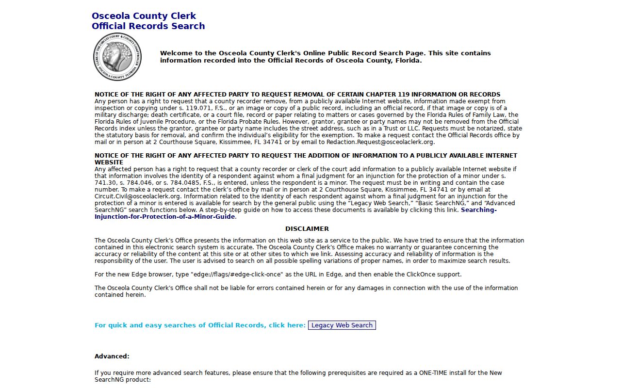
Result details may include direct and reverse parties, recording time, page count, legal-description fields, linked instruments, and an image control when remote viewing is allowed.
When no image appears, use the Clerk's historical subdivision, section-land, township-range, or plat index to find book and page. Then request the instrument by email, mail, counter service, or JustFOIA. The off-site Records Center holds some material from 1882 and mostly records from 1887 through 2009, but it is not open for routine browsing. Call the owning department first.
Note: A modern street string may fail in an old index, while the subdivision, lot, block, and book-page citation can still bridge the gap.
Kissimmee Street Copies and Fees
Searching the public Official Records index appeared free. A copy is a separate product. The Clerk's published schedule lists ordinary pages at $1, plat pages at $5, and certification at $2 per instrument. A mail order needs payment and a self-addressed postage-paid envelope. The courthouse at 2 Courthouse Square is open weekdays from 8 a.m. to 5 p.m., excluding holidays, with a 4:30 p.m. recording and payment cutoff.
The Clerk recording FAQ explains recorded categories, order channels, and current charges.
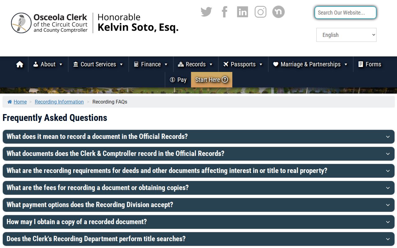
Check that page again before paying. Electronic certified delivery may also add a third-party charge.
Map Parcels Along Kissimmee Streets
GIS turns a list into geography. Search or geocode an address, zoom to parcel lines, select the target, and open its parcel detail. Then pan to the lots next door and across the road. City services expose address points, parcels, street centerlines, aerials, zoning, future land use, flood, downtown and Vine Street CRA areas, development, and EnerGov layers. Some map queries cap results at 1,000 records.
Map context is useful, but it is not a household roll. Condominiums may have unit parcels, while an apartment complex may sit on one common parcel. Aerials and zoning explain the site, not its occupants. Use the full named-street workflow here; use the immediate block method on the Kissimmee neighbors page.
A mapped selection can also help frame a narrow records request. Instead of asking a custodian for every file on a long road, provide the parcel number, project address, department, record type, and date range. Florida law does not require a requester to state a purpose. The office may charge actual duplication cost and a reasonable special-service fee for extensive work, so a focused request can cut both search time and cost.
Postal Kissimmee Is Often Wider
The words “Kissimmee, FL” do not prove that a parcel is inside the City of Kissimmee. Buena Ventura Lakes, Celebration, Poinciana, and other county areas can use Kissimmee as a postal city. This quirk changes where a street directory researcher requests permits, police reports, or code records.
Check the address three ways. USPS standardizes the mailing address and ZIP. City GIS shows city limits and service areas. The Property Appraiser supplies the situs, county parcel, and legal description. If the lot is inside the city, planning records may run through EnerGov. An unincorporated parcel routes to county offices. A permit can date a reroof, pool, addition, demolition, or change of use, yet an applicant or contractor is not proof of residence.
Older Kissimmee Streets Need Context
Historical street work has verified but sparse anchors. The 1887 Orange County Gazetteer and Business Directory includes Kissimmee, and the 1921 Polk's Kissimmee and Osceola County Directory is cited in federal historic-district documentation. Neither finding supports a claim that every year or every household is available. The May 1889 Sanborn map adds building footprints, uses, and street names.
Osceola County was created from Orange and Brevard counties in May 1887. A pre-formation street or land trail may therefore continue in predecessor-county records. The Kissimmee city directory collections explain the verified volumes and shelf checks without turning a two-year finding into a false continuous run.
Limits of a Kissimmee Street Directory
Parcel ownership does not identify every person who occupies a home. Renters and other household members are not ordinary parcel fields. The owner mailing address may be far from the property. Homestead does not list a household. Utility and delivery customer data are not an open resident directory, and DMV-derived address information is controlled by federal law.
Voter status can support a match, but the public individual lookup is not a browse-by-street tool. A lawful file request remains subject to protected-address rules. Full identification numbers, signatures, and confidentiality-program data are not open street fields. An inactive voter record is also not proof that someone just moved.
Lawful use. Use Kissimmee address records for legitimate personal research. Never use a street search to stalk, harass, threaten, or defeat a protected person's confidentiality.